Our Geography
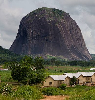
Nigeria is the most populous country in Africa. It lies on the Gulf of Guinea in West Africa, roughly between longitudes 3°E and 14°E and latitudes 4°N and 14°N, with a land area of 923,766 square kilometres and about 800 kilometres of coastline.
Location and neighbours
The country shares borders with the Republic of Niger and the Republic of Chad to the north, the Republic of Benin to the west, and the Republic of Cameroon to the east down to the Atlantic Ocean. The lower course of the Niger River flows south through the western part of the country into the Gulf of Guinea. Swamps and mangrove forests line much of the southern coast. Inland, hardwood forests give way to open savanna toward the north.
Climate
Temperatures are generally high, with a fairly narrow seasonal and daily range of about 22 to 36°C. There are two main seasons: the wet season from April to October, and the dry season from November to March.
The dry season often begins with the Harmattan, a cooler, dusty spell that can last into February when north-easterly winds carry fine dust from the Sahara. From February to March, temperatures commonly rise to about 33 to 38°C. The wettest conditions are usually along the south-eastern coast, where annual rainfall can reach around 330 centimetres. The driest and hottest extremes are more typical of the northern third of the country.
Vegetation
Rainfall shapes two broad vegetation belts, forests in the wetter south and savanna in the drier north. Each belt has several variants that run roughly east to west across the country.
- Forest types Saline water swamp, fresh water swamp, and tropical evergreen rainforest
- Savanna types Guinea, Sudan, and Sahel savanna
- Highland areas Plateau vegetation around Jos, Mambila, and Obudu
The Guinea and Sudan savanna zones support much of the country’s grain, tuber, vegetable, and cotton production. The evergreen rainforest belt supports timber, cassava, and plantation crops such as citrus, oil palm, cocoa, and rubber.